Nos Projets Photogrammétrie
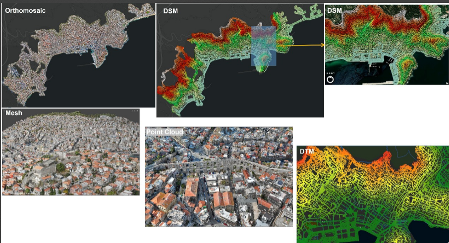
Commune de Kavala
Un nuage de points est généré pour restituer chaque détail en 3D.
Un modèle 3D texturé permet une visualisation immersive.
Le DSM représente les hauteurs (bâtiments, végétation), tandis que le DTM extrait le relief naturel.
Une orthomosaïque géoréférencée offre une image haute résolution du territoire.
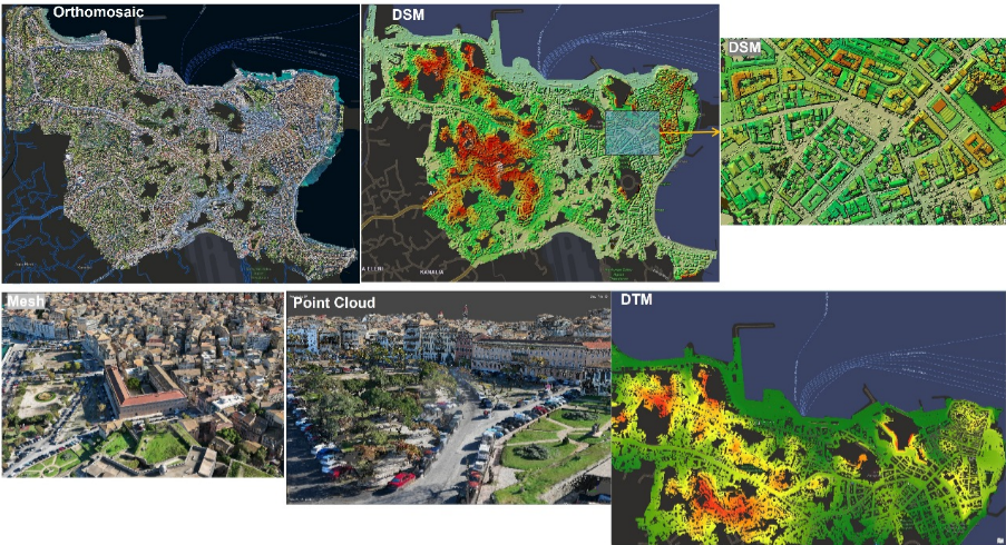
Commune de Kerkyra
Production d’un nuage de points dense pour une meilleure précision spatiale.
Un maillage 3D texturé restitue fidèlement le centre urbain.
Les DSM et orthophotos facilitent l’analyse du territoire.
Prêt à être intégré dans tout projet de cartographie et aménagement.